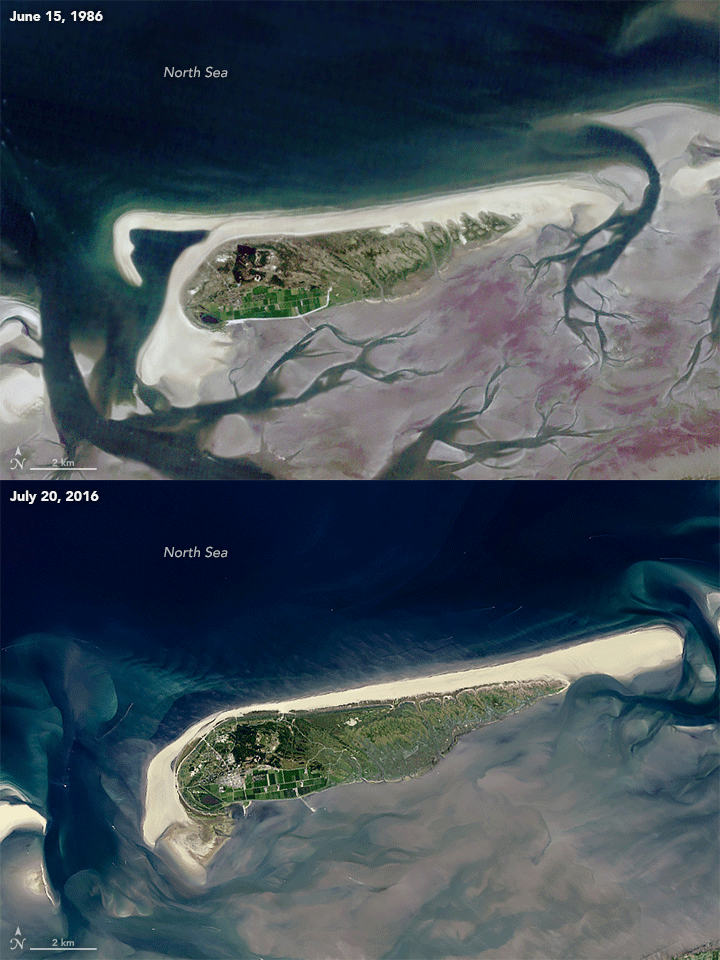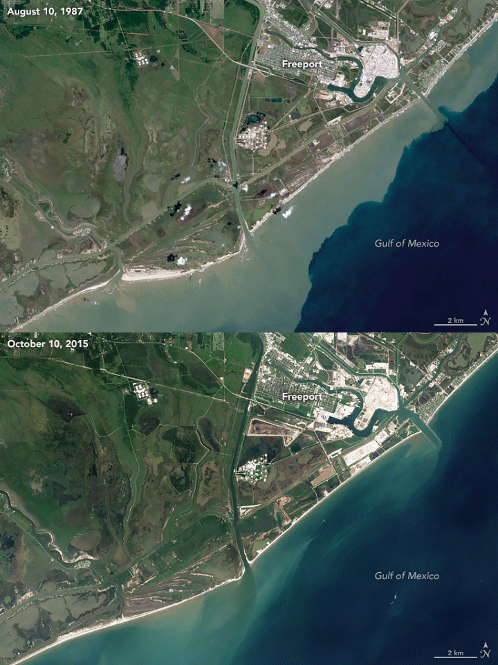
Since the 1980s, NASA has been closely monitoring the planet’s coastlines, tracking erosion, growth, and the shifting nature of sandy beaches. Using satellite imagery and machine learning, researchers have mapped out changes over the past three decades. These satellite surveys show a complex picture: while some sandy beaches are growing, others—especially in marine-protected areas—are eroding at alarming rates.
Data collected by Landsat satellites reveals that approximately 31% of the world’s coastlines are sandy. In Africa, sandy beaches are most common, with 66% of coastlines composed of sand, while Europe has the fewest at 22%. However, the team also found that nearly 24% of the sandy beaches are eroding, with four of the largest erosion hotspots located in the U.S.
Among the fastest-growing beaches, Schiermonnikoog in the Netherlands stands out, with nearly 10 meters of growth per year. In stark contrast, Freeport, Texas, faces one of the largest erosive threats, losing almost 15 meters of beach annually along an 11-mile stretch.

“It took just a few months of satellite data to map annual shoreline changes globally,” says lead researcher Arjen Luijendijk. This technology offers unparalleled insight into long-term coastal dynamics without the labor-intensive process of aerial image analysis.
The research also highlights a troubling trend: nearly 37% of beaches in marine-protected areas are eroding, despite being shielded from human intervention. Meanwhile, human activities in non-protected zones, like sand mining in Vietnam’s Mekong Delta, are accelerating erosion at dangerous rates.
As coastal populations continue to grow and climate change threatens shorelines, NASA’s ongoing satellite observations offer critical data to safeguard these ecosystems and protect vulnerable coastal communities from future impacts.